
Oversee and Manage Site Conditions
Type of resources
Topics
Keywords
Contact for the resource
Provided by
Years
Formats
Representation types
Update frequencies
status
-
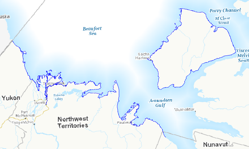
In the face of increasing economic opportunities in Canada's northern regions, the need to improve our state of preparedness for oil spill related emergencies in particular is critical. While significant efforts have been put towards documenting baseline coastal information across Canada’s southern regions, there is a large information gap regarding Arctic shorelines. Baseline coastal information such as shoreline form, substrate and vegetation type, is required for operational prioritization, coordination of on-site spill response activities (i.e., SCAT: Shoreline Cleanup and Assessment Technique), as well as providing valuable information for wildlife and ecosystem management. A standardized methodology was developed to map shoreline characteristics at six study sites across the Canadian Arctic: James Bay, Resolute Bay, Hudson Bay, Labrador Coast, Victoria Strait, and Beaufort Sea. Geo-referenced high definition videography was collected during the summers of 2010 to 2012 along coastlines within the study sites. Detailed information (i.e. shoreline type, substrate, form, height, slope, fetch, access type, exposure, etc.) describing the upper intertidal, supratidal, and backshore zones was extracted from the video and entered into a geospatial database using a data collection form. This information was used to delimit and map alongshore segments in the upper intertidal zone. The result is a vector dataset containing thousands of linear shoreline segments ranging in length from 200 m and 2 km long. In total, almost seven thousand kilometers of northern shorelines were mapped, including twenty five different shoreline types based on the upper intertidal zone. This information will feed into a larger ongoing project focused on Arctic coastal ecosystems as well as serve as valuable information for oil spill response planning should the need arise. This database also provides valuable information for habitat management, local shoreline planning, can feed into environmental assessments or be used to aid research site selection.
-
Since 1988, the governments of Canada and Quebec have been working together to conserve, restore, protect and develop the St. Lawrence River under the St. Lawrence Action Plan (SLAP). One of the projects identified under the theme of biodiversity conservation is the development of an integrated plan for the conservation of the natural environments and biodiversity of the St. Lawrence River. The identification of priority sites for conservation has been the first step of this planning exercise. Conservation planning of natural environments requires a reliable, accurate and up-to-date image of the spatial distribution of ecosystems in the study area. In order to produce an Atlas of Priority Sites for Conservation in the St. Lawrence Lowlands, an updated cartography of the land cover of this vast territory was undertaken. This project required obtaining reliable information on the natural environments of the St. Lawrence Lowlands. Although several land cover mapping projects have been conducted for specific types of habitats, it was particularly important to obtain a homogeneous product that would cover the entire territory and that would provide the most detailed information on its various thematic components: agricultural, aquatic, human-modified and forest environments, wetlands as well as old fields and bare ground. The methodology used to produce the land cover mapping of the St. Lawrence Lowlands thus relied mainly on combining and enhancing the best existing products for each theme. This project was made in collaboration with MDDELCC as part of the St. Lawrence Action Plan (SLAP). This dataset includes land cover polygons within a 10 km radius of the Centre-du-Québec administrative region within the St. Lawrence Lowlands.
-
Since 1988, the governments of Canada and Quebec have been working together to conserve, restore, protect and develop the St. Lawrence River under the St. Lawrence Action Plan (SLAP). One of the projects identified under the theme of biodiversity conservation is the development of an integrated plan for the conservation of the natural environments and biodiversity of the St. Lawrence River. The identification of priority sites for conservation has been the first step of this planning exercise. Conservation planning of natural environments requires a reliable, accurate and up-to-date image of the spatial distribution of ecosystems in the study area. In order to produce an Atlas of Priority Sites for Conservation in the St. Lawrence Lowlands, an updated cartography of the land cover of this vast territory was undertaken. This project required obtaining reliable information on the natural environments of the St. Lawrence Lowlands. Although several land cover mapping projects have been conducted for specific types of habitats, it was particularly important to obtain a homogeneous product that would cover the entire territory and that would provide the most detailed information on its various thematic components: agricultural, aquatic, human-modified and forest environments, wetlands as well as old fields and bare ground. The methodology used to produce the land cover mapping of the St. Lawrence Lowlands thus relied mainly on combining and enhancing the best existing products for each theme. This project was made in collaboration with MDDELCC as part of the St. Lawrence Action Plan (SLAP). This dataset includes land cover polygons within a 10 km radius of the Laurentides administrative region within the St. Lawrence Lowlands.
-
Since 1988, the governments of Canada and Quebec have been working together to conserve, restore, protect and develop the St. Lawrence River under the St. Lawrence Action Plan (SLAP). One of the projects identified under the theme of biodiversity conservation is the development of an integrated plan for the conservation of the natural environments and biodiversity of the St. Lawrence River. The identification of priority sites for conservation has been the first step of this planning exercise. Conservation planning of natural environments requires a reliable, accurate and up-to-date image of the spatial distribution of ecosystems in the study area. In order to produce an Atlas of Priority Sites for Conservation in the St. Lawrence Lowlands, an updated cartography of the land cover of this vast territory was undertaken. This project required obtaining reliable information on the natural environments of the St. Lawrence Lowlands. Although several land cover mapping projects have been conducted for specific types of habitats, it was particularly important to obtain a homogeneous product that would cover the entire territory and that would provide the most detailed information on its various thematic components: agricultural, aquatic, human-modified and forest environments, wetlands as well as old fields and bare ground. The methodology used to produce the land cover mapping of the St. Lawrence Lowlands thus relied mainly on combining and enhancing the best existing products for each theme. This project was made in collaboration with MDDELCC as part of the St. Lawrence Action Plan (SLAP).
-
Since 1988, the governments of Canada and Quebec have been working together to conserve, restore, protect and develop the St. Lawrence River under the St. Lawrence Action Plan (SLAP). One of the projects identified under the theme of biodiversity conservation is the development of an integrated plan for the conservation of the natural environments and biodiversity of the St. Lawrence River. The identification of priority sites for conservation has been the first step of this planning exercise. Conservation planning of natural environments requires a reliable, accurate and up-to-date image of the spatial distribution of ecosystems in the study area. In order to produce an Atlas of Priority Sites for Conservation in the St. Lawrence Lowlands, an updated cartography of the land cover of this vast territory was undertaken. This project required obtaining reliable information on the natural environments of the St. Lawrence Lowlands. Although several land cover mapping projects have been conducted for specific types of habitats, it was particularly important to obtain a homogeneous product that would cover the entire territory and that would provide the most detailed information on its various thematic components: agricultural, aquatic, human-modified and forest environments, wetlands as well as old fields and bare ground. The methodology used to produce the land cover mapping of the St. Lawrence Lowlands thus relied mainly on combining and enhancing the best existing products for each theme. This project was made in collaboration with MDDELCC as part of the St. Lawrence Action Plan (SLAP). This dataset includes land cover polygons within a 10 km radius of the Bas-Saint-Laurent administrative region within the St. Lawrence Lowlands.
-
Since 1988, the governments of Canada and Quebec have been working together to conserve, restore, protect and develop the St. Lawrence River under the St. Lawrence Action Plan (SLAP). One of the projects identified under the theme of biodiversity conservation is the development of an integrated plan for the conservation of the natural environments and biodiversity of the St. Lawrence River. The identification of priority sites for conservation has been the first step of this planning exercise. Conservation planning of natural environments requires a reliable, accurate and up-to-date image of the spatial distribution of ecosystems in the study area. In order to produce an Atlas of Priority Sites for Conservation in the St. Lawrence Lowlands, an updated cartography of the land cover of this vast territory was undertaken. This project required obtaining reliable information on the natural environments of the St. Lawrence Lowlands. Although several land cover mapping projects have been conducted for specific types of habitats, it was particularly important to obtain a homogeneous product that would cover the entire territory and that would provide the most detailed information on its various thematic components: agricultural, aquatic, human-modified and forest environments, wetlands as well as old fields and bare ground. The methodology used to produce the land cover mapping of the St. Lawrence Lowlands thus relied mainly on combining and enhancing the best existing products for each theme. This project was made in collaboration with MDDELCC as part of the St. Lawrence Action Plan (SLAP). This dataset includes land cover polygons within a 10 km radius of the Outaouais administrative region within the St. Lawrence Lowlands.
-
Since 1988, the governments of Canada and Quebec have been working together to conserve, restore, protect and develop the St. Lawrence River under the St. Lawrence Action Plan (SLAP). One of the projects identified under the theme of biodiversity conservation is the development of an integrated plan for the conservation of the natural environments and biodiversity of the St. Lawrence River. The identification of priority sites for conservation has been the first step of this planning exercise. Conservation planning of natural environments requires a reliable, accurate and up-to-date image of the spatial distribution of ecosystems in the study area. In order to produce an Atlas of Priority Sites for Conservation in the St. Lawrence Lowlands, an updated cartography of the land cover of this vast territory was undertaken. This project required obtaining reliable information on the natural environments of the St. Lawrence Lowlands. Although several land cover mapping projects have been conducted for specific types of habitats, it was particularly important to obtain a homogeneous product that would cover the entire territory and that would provide the most detailed information on its various thematic components: agricultural, aquatic, human-modified and forest environments, wetlands as well as old fields and bare ground. The methodology used to produce the land cover mapping of the St. Lawrence Lowlands thus relied mainly on combining and enhancing the best existing products for each theme. This project was made in collaboration with MDDELCC as part of the St. Lawrence Action Plan (SLAP). This dataset includes land cover polygons within a 10 km radius of the Montréal administrative region.
-
Since 1988, the governments of Canada and Quebec have been working together to conserve, restore, protect and develop the St. Lawrence River under the St. Lawrence Action Plan (SLAP). One of the projects identified under the theme of biodiversity conservation is the development of an integrated plan for the conservation of the natural environments and biodiversity of the St. Lawrence River. The identification of priority sites for conservation has been the first step of this planning exercise. Conservation planning of natural environments requires a reliable, accurate and up-to-date image of the spatial distribution of ecosystems in the study area. In order to produce an Atlas of Priority Sites for Conservation in the St. Lawrence Lowlands, an updated cartography of the land cover of this vast territory was undertaken. This project required obtaining reliable information on the natural environments of the St. Lawrence Lowlands. Although several land cover mapping projects have been conducted for specific types of habitats, it was particularly important to obtain a homogeneous product that would cover the entire territory and that would provide the most detailed information on its various thematic components: agricultural, aquatic, human-modified and forest environments, wetlands as well as old fields and bare ground. The methodology used to produce the land cover mapping of the St. Lawrence Lowlands thus relied mainly on combining and enhancing the best existing products for each theme. This project was made in collaboration with MDDELCC as part of the St. Lawrence Action Plan (SLAP). This dataset includes land cover polygons within a 10 km radius of the Capitale-Nationale administrative region within the St. Lawrence Lowlands.
-
Since 1988, the governments of Canada and Quebec have been working together to conserve, restore, protect and develop the St. Lawrence River under the St. Lawrence Action Plan (SLAP). One of the projects identified under the theme of biodiversity conservation is the development of an integrated plan for the conservation of the natural environments and biodiversity of the St. Lawrence River. The identification of priority sites for conservation has been the first step of this planning exercise. Conservation planning of natural environments requires a reliable, accurate and up-to-date image of the spatial distribution of ecosystems in the study area. In order to produce an Atlas of Priority Sites for Conservation in the St. Lawrence Lowlands, an updated cartography of the land cover of this vast territory was undertaken. This project required obtaining reliable information on the natural environments of the St. Lawrence Lowlands. Although several land cover mapping projects have been conducted for specific types of habitats, it was particularly important to obtain a homogeneous product that would cover the entire territory and that would provide the most detailed information on its various thematic components: agricultural, aquatic, human-modified and forest environments, wetlands as well as old fields and bare ground. The methodology used to produce the land cover mapping of the St. Lawrence Lowlands thus relied mainly on combining and enhancing the best existing products for each theme. This project was made in collaboration with MDDELCC as part of the St. Lawrence Action Plan (SLAP). This dataset includes land cover polygons within a 10 km radius of the Chaudière-Appalaches administrative region within the St. Lawrence Lowlands.
-
Since 1988, the governments of Canada and Quebec have been working together to conserve, restore, protect and develop the St. Lawrence River under the St. Lawrence Action Plan (SLAP). One of the projects identified under the theme of biodiversity conservation is the development of an integrated plan for the conservation of the natural environments and biodiversity of the St. Lawrence River. The identification of priority sites for conservation has been the first step of this planning exercise. Conservation planning of natural environments requires a reliable, accurate and up-to-date image of the spatial distribution of ecosystems in the study area. In order to produce an Atlas of Priority Sites for Conservation in the St. Lawrence Lowlands, an updated cartography of the land cover of this vast territory was undertaken. This project required obtaining reliable information on the natural environments of the St. Lawrence Lowlands. Although several land cover mapping projects have been conducted for specific types of habitats, it was particularly important to obtain a homogeneous product that would cover the entire territory and that would provide the most detailed information on its various thematic components: agricultural, aquatic, human-modified and forest environments, wetlands as well as old fields and bare ground. The methodology used to produce the land cover mapping of the St. Lawrence Lowlands thus relied mainly on combining and enhancing the best existing products for each theme. This project was made in collaboration with MDDELCC as part of the St. Lawrence Action Plan (SLAP). This dataset includes land cover polygons within a 10 km radius of the Laval administrative region.